Buyers who cross-shop Waneta and Lamoka against Keuka or Seneca usually arrive with the same mental model: frontage times a per-foot number, adjusted for view and slope. That math works on the Finger Lakes. On these two smaller lakes, it quietly leaves out the party that actually controls the water you're buying against.
The shoreline you tour in August is not a natural equilibrium. It's a regulated one, set by a federal license held by a utility, and it behaves differently from anything a few miles east or west. If you're deciding whether to spend Keuka money to be on Keuka or Waneta money to be on Waneta, that distinction is the trade you're actually making.
The federal license nobody mentions at the showing
Waneta and Lamoka once fed a NYSEG hydroelectric plant on the east shore of Keuka through a pipe system that pulled water off the north end of Waneta. That plant is long gone, but the plumbing that made it possible still governs the lakes. NYSEG was granted a non-power license in the late 1990s, and since then the lakes' water level is controlled by a NYSEG dam and spillway located at the south end of Mill Pond.
The license is not decorative. The Federal Energy Regulatory Commission mandates a depth control limit of 1099 to 1096 feet, with a summer limit from Memorial Day to October 1st of 1099 to 1098 feet.
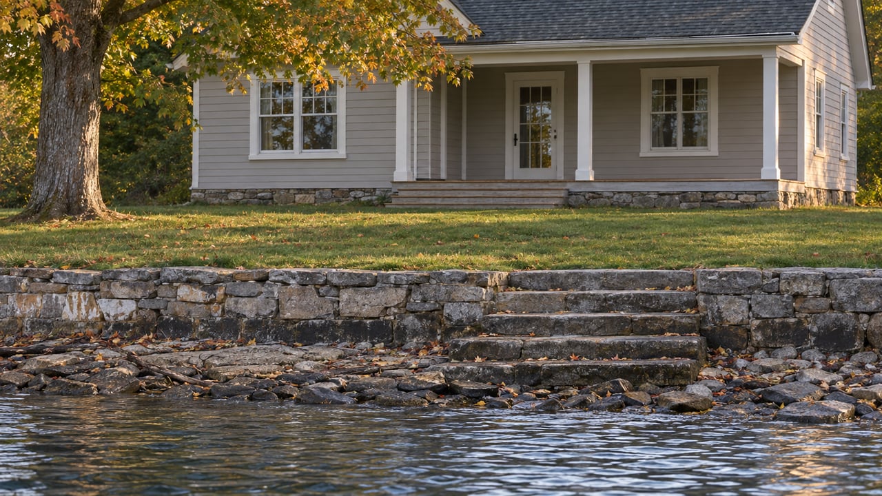
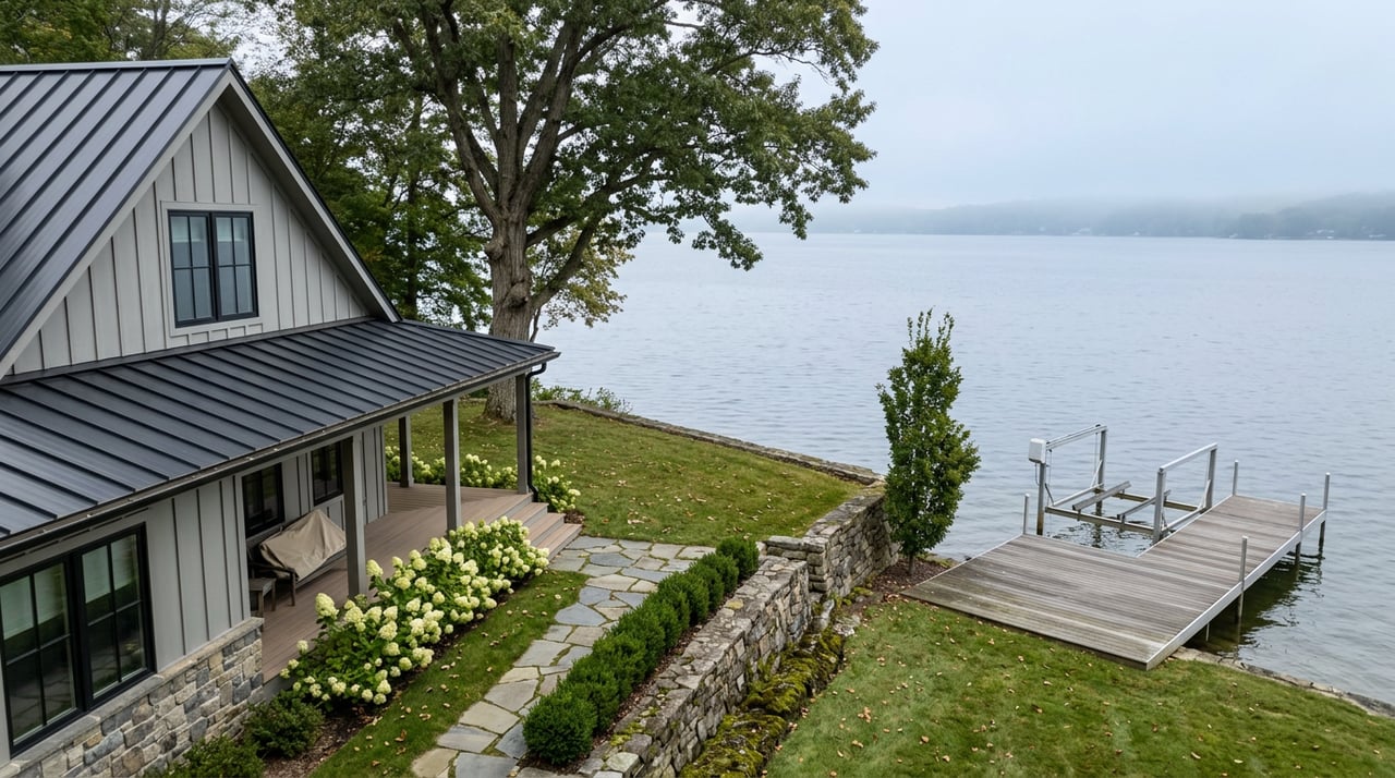
Practically, that means the summer water you see from the dock is a one-foot band that the utility is federally obligated to hold. It also means fall drawdown is not a rumor or a weather event. It is a schedule.
For a buyer, three things follow. Your dock design has to work at the top and bottom of a defined range, not against a "typical" lake year. Shoreline hardening, stairs, and boat lifts get engineered against a known elevation, which is a gift compared to guessing. And if you are told a seller's dock has "always worked fine," the correct question is which decade of the license they are describing.
Why the channel is the second contract you're signing
The two lakes look like one property from a satellite view. They are not. They are joined by a narrow, state-owned wetland corridor, and whether you can move between them by boat depends on infrastructure you don't own.
Lamoka is an approximately 588-acre lake about two miles west of Tyrone, often mentioned collectively with Waneta just to the north and connected by a 0.7-mile channel that flows through the Waneta-Lamoka Wildlife Management Area. A bridge that crosses the middle of the channel has recently been upgraded and allows most low-profile boats to travel between the lakes without pulling the boat out of the water.
Two words in there earn their weight. "Most" and "low-profile." Pontoons with tall canopies, taller center consoles, and anything with a hardtop are not part of "most." If you buy on Lamoka and picture dinner runs to a friend's dock on Waneta, walk the CR 23 bridge before you sign anything and measure the clearance yourself at summer pool.
The channel itself is not deep water. The state's own guidance is blunt about it. A state boat launch is located on the channel at the north end of Lamoka Lake off of County Route 23, two miles west of the Hamlet of Tyrone, and the agency cautions boaters that the channel can be shallow in some areas, especially during late summer when lake levels may be lower.
Late summer is when second-home owners are actually here. That is the friction. The lake elevation is federally banded, but the channel bottom is not, and the practical crossing window narrows as August wears on.
These lakes don't drain where you think they drain
Because Waneta and Lamoka sit on the map beside Keuka and Seneca, buyers assume they are Finger Lakes. Hydrologically, they are not, and that has consequences for how you think about water quality, fishery, and long-term shoreline behavior.
Both Lamoka and Waneta are east of Keuka, but they are not part of the Finger Lakes drainage system. While the Finger Lakes drain north into the St. Lawrence River system, Lamoka and Waneta drain south into Mill Pond, then Mud Creek, and then to the Cohocton River in the Susquehanna River system.
The depth story is the second half of that difference. The surface of Lamoka is 1,100 feet above sea level, its maximum depth is 40 feet, and the total surface area is 824 acres bounded by about eleven miles of shoreline. That is a warm, shallow, weedy fishery, not a cold, deep one. Sometimes known as the minor or baby Finger Lakes, they are not deep enough to support a trout fishery, but are a fantastic warm-water habitat.
Here is the shorthand a buyer can carry into a showing:
| Attribute | Waneta & Lamoka | Keuka / Seneca |
|---|---|---|
| Drainage basin | Susquehanna (south) | St. Lawrence (north) |
| Level control | NYSEG dam under FERC license | Natural, with outlet controls |
| Max depth | ~40 ft (Lamoka) | 187 ft (Keuka) / 618 ft (Seneca) |
| Fishery type | Warm-water: bass, pickerel, muskellunge | Cold-water: lake trout, landlocked salmon |
| Inter-lake travel | Single low-clearance channel bridge | Not applicable |
None of this is a knock on Waneta and Lamoka. It is the reason a comparable-looking cottage here is priced the way it is, and the reason "just like Keuka but cheaper" is the wrong frame for the decision.
What that actually means when you're pricing a cottage here
If you're a buyer or an appraiser working from Finger Lakes comps, the adjustments you need to make are specific and mostly one-directional.
- Dock and lift specs are governed by a known band, not a guess. Ask the seller for photos at spring high water and October drawdown. The FERC range gives you a real answer, not a story.
- Shoreline shading and weed pressure are structural, not seasonal. In a warm shallow lake with abundant aquatic vegetation, waterfront maintenance is a recurring cost. Largemouth bass can be found all around the lake in shallow water areas, especially in Fleet Cove, and during most summers poor oxygen levels limit fish and fishing to the upper 20 feet of the lake. Weed treatment schedules and association participation matter more than they would on Seneca.
- Ice-in and ice-out change the calendar. Excellent ice fishing opportunities exist within Lamoka, with anglers targeting pickerel and panfish species. A property here has a real winter use case that a deep Finger Lake doesn't. That is a lifestyle asset and, for the right buyer, a rental angle.
- Association posture is not optional. The Lamoka Waneta Lakes' Association has been organized since 1938 and its board meets at Tyrone Town Hall on the third Saturday from April through October, based on the association's own calendar. If you're buying here, you're buying into a community that already coordinates on weed management, water quality, and NYSEG-related items. Ask which committees the seller sits on.
- Buildable shoreline is finite in a way it isn't on the larger lakes. Except for the northernmost portion of the lake, the shoreline is composed of year-round and seasonal homes and cottages. New frontage rarely comes online. Turnover, not development, is the supply story.
The through-line for pricing: what looks like a discount to Keuka is compensation for a smaller, warmer, federally regulated water body with a single choke-point between its two halves. That is not a bad trade. It is a specific trade, and the buyers who do best here are the ones who priced it deliberately.
A short FAQ
Are Waneta and Lamoka considered Finger Lakes? Geologically related, hydrologically separate. They drain south into the Susquehanna system rather than north into the St. Lawrence, which is the working definition most local sources use.
Can I keep my Keuka-sized boat here? On the open water of either lake, usually yes within local rules. Between the two lakes, only if it clears the CR 23 channel bridge at summer pool. Measure before you buy.
Who actually controls the water level? NYSEG, under a non-power license administered by FERC, using the dam and spillway at the south end of Mill Pond. The summer band is 1098 to 1099 feet.
Is there a historic overlay that could affect a nearby parcel? The area is the location of a significant archaeological site, the Lamoka site, which the National Park Service describes as providing the first clear evidence of an Archaic hunting and gathering culture in the Northeastern United States around 3500 BC, and the site was designated a National Historic Landmark in 1961. It's a small footprint, but worth asking about on adjoining parcels.
If you're comparing a cottage here to something on Keuka or Seneca and the per-foot numbers aren't lining up with what you're seeing on the ground, that's usually where the real conversation starts. Nick Davoli works these lakes as a specialty, not a sideline, and can walk you through the shoreline, the channel, and the license before you write an offer. When you're ready to compare properties side by side, let's connect.